Janjeva

Listing

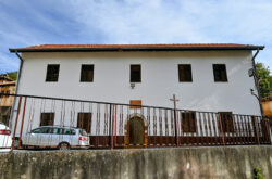
The building is of special importance, it is old, it has a special style, but the most important thing is that during the 50s it served as a school (gymnasium) from the fifth grade up. Georeference: 42.574135,21.246813 Plus Code – Google Maps: H6FW+MP4 Јаnjevë Category: Culture Subcategory: Building Legal protection… Read more…

The facility has a special importance because schools are one of the main institutions. The special feature of this school is that the other minorities, like the Croatians, continue to learn in their own language. Georeference: 42.570993, 21.247886 Plus Code – Google Maps: H6CX+95R Janjevo Category: Culture Subcategory: Facility/School Legal… Read more…

It is important because the building served as a school after the second world conflict, now it is used as an auxiliary facility of the Church. Georeference: 42.573676, 21.248898 Plus Code – Google Maps: H6FX+FHC Јаnjeva Category: Culture Subcategory: Facility / School Legal protection status: No Is it used for…

Janjeva’s Bazaar

H6FW+JQW Janjevo

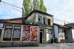
In the Bazaar (Çarshia) of Janjevë/Janjevo there are several restaurants and several markets serving the inhabitants of Janjevë/Janjevo. This bazaar serves as a gathering place for the residents of Janjevë/Janjevo where they can walk, have coffee, as its appearance looks like an old city, the residents pointed out. Georeference: 42.5741048,… Read more…

Children/students from several surrounding villages study in this school and it has a large capacity of up to 500 students. The “Emin Duraku” school was a symbol of education, during the years 1999 it served as a school for 32 villages of the municipality of Lipjan/Lipljan. Georeference: 42.5145563, 21.1558988 Plus…