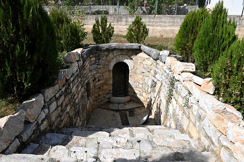
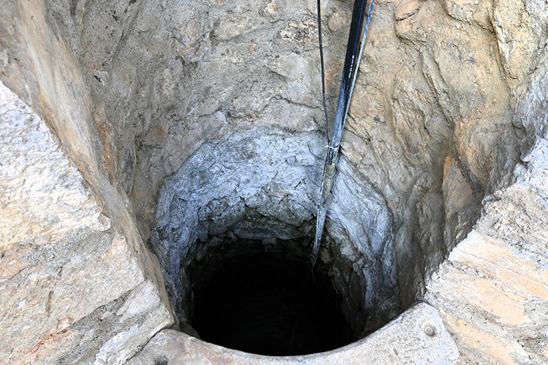
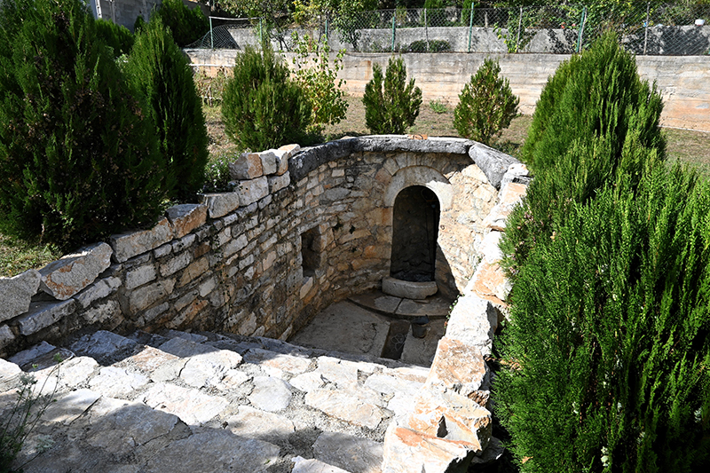
The well of the Olluri family – Krojmir/Krajmirovce

FWPH+GX7 Krojmir

This source of water is over 200 years old, the same is used for domestic needs today.

Georeference: 42.486284, 20.929923
Plus Code – Google Maps: FWPH+GX7 Krojmir
Category: Nature
Subcategory: Water source
Legal protection status: Yes
Is it used for tourism? Yes
Is there potential for tourism in the future? /
Road infrastructure to the location: Good
Signs and orientation to the location: There are no road signs
Boards on site: There is no board at all

Visited 259 times, 2 Visits today

Posted in Nature and Water Source

Related Listings

The Hunting Ground of Special Importance “Blinajë/Blinaje”, extends to three municipalities, that of Lipjan/ Lipljan, Drenas/Glogovac and Shtimje/ Štimlje and has an area of 2795 ha. This hunting ground is of the closed type and lies at an altitude of 650-850 m above sea level, and has 40 ha of… Read more…

Water Source 1

H7G2+GF5 Janjevo

This location serves the residents of Janjevë/Janjevo for water supply. It is an old and characteristic fountain for the village of Janjevë/Janjevo. Georeference: 42.5762545, 21.2512275 Plus Code – Google Maps: H7G2+GF5 Јаnjevë Category: Nature Subcategory: Water Source Legal protection status: No Is it used for tourism? No Is there potential… Read more…

The walking trail “Pishat” – is a marked walking trail, the beginning of which is located in the western part of Janjevë/Janjevo and is intended to connect Janjevë/Janjevo (as a locality rich in cultural heritage values) with Graçanicë/Gračanica. Accordingly, an attempt has been made to create a kind of network… Read more…